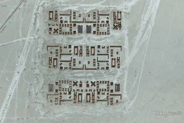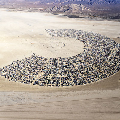
Burning Man Aerials – Black Rock City, Nevada
Burning Man Aerials – Black Rock City, Nevada 2019 Flying to Burning Man in 2019 Earlier this month I insisted on flying to Burning Man for the sole purpose of seeing Black Rock City from 3,000 feet. As we refueled in Winnemucca airport (I was staring at the posters on the FBO wall and eating…